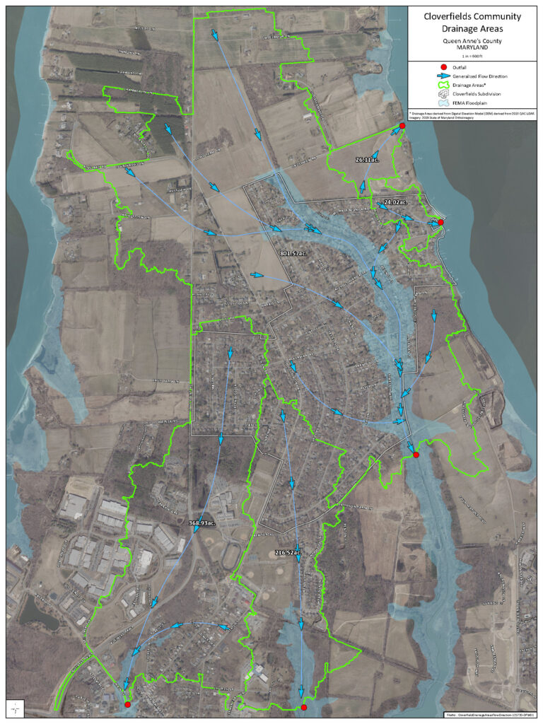
There are 3 sub-basins in the drainage area.
| Sub-Basin | Area (acres) |
| Basin 1 | 332.8 |
| Basin 2 | 179.2 |
| Basin 3 | 204.8 |
| Total Drainage Area | 716.8 |

There are 3 sub-basins in the drainage area.
| Sub-Basin | Area (acres) |
| Basin 1 | 332.8 |
| Basin 2 | 179.2 |
| Basin 3 | 204.8 |
| Total Drainage Area | 716.8 |