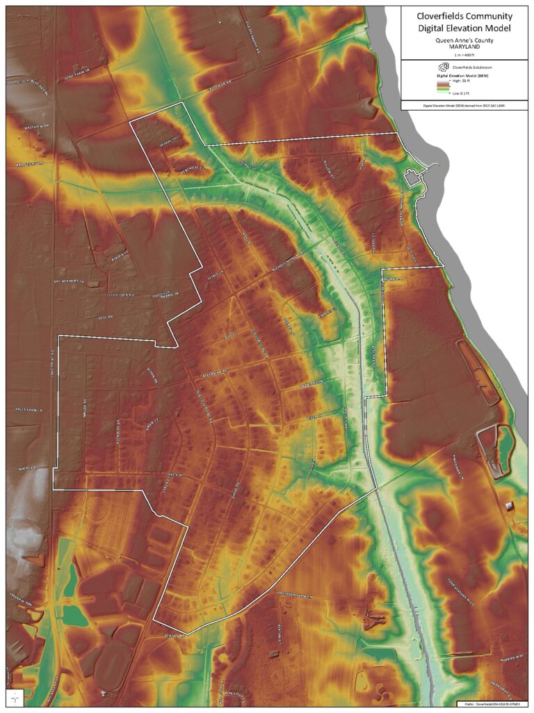
The Cloverfields community is located in the Cox Creek watershed in Queen Anne’s County, Maryland. Water flows from north to south over this region of Kent Island. The Cloverfields drainage area drains 1.12 square miles (717 acres) of land upstream of Ackerman Road. The entire watershed is contained within the Eastern Coastal Plain Region. Part of the drainage for the community, which follows historic patterns, now forms a blue line stream on google maps. A riverine floodplain exists on either side of this blue line stream which form the headwaters of Cox Creek. While most people view a river or stream only as the place where there is regularly flowing water, the reality is that the river and floodplain are one integrated system that have evolved over time to convey water and sediment downstream, with the floodplain serving to both store water and to slowly release it back into the main channel of the river as the flood passes, to ensure that the natural system downstream isn’t overwhelmed.
Constructed before modern day floodplain and building regulations, certain areas of the Cloverfields subdivision are vulnerable to tidal and riverine flooding. Depending on the degree of damage, flood events range from general nuisance flooding events that have low levels of inundation that do not pose significant threats to public safety or major property damage to major events that pose significant threats to public safety and severe property damage.
Drainage Complaints: https://qacmd.seamlessdocs.com/f/cloverfields_drainage
Questions/comments, email: cloverfields-drainage@qac.org